
Monitoring conditions during a field campaign
By Tobias Müller. Published . Updated .
A field crew plans a week of work at Big Bar on the Fraser River, in the Fraser Canyon of British Columbia. The site sits about 50 km northwest of Clinton and is reached by gravel roads. Cell coverage is poor, the drive is long, and a wasted trip costs a lot of money. Before the crew leaves, and every morning during the campaign, someone needs to know the river level, the air temperature, the active weather warnings, and the state of the roads.
Each of those answers lives on a different website. Checking them by hand takes time and is easy to forget on a busy morning. This walkthrough shows how to bring all that information into one place with Warnspot. The goal is to send automated notifications to the crew when conditions are unsafe.
Create a location of interest
In Warnspot, locations are a way to organize your monitoring data. A location ties together your data sources, your notifications, the weather forecast, and public alerts for one place.
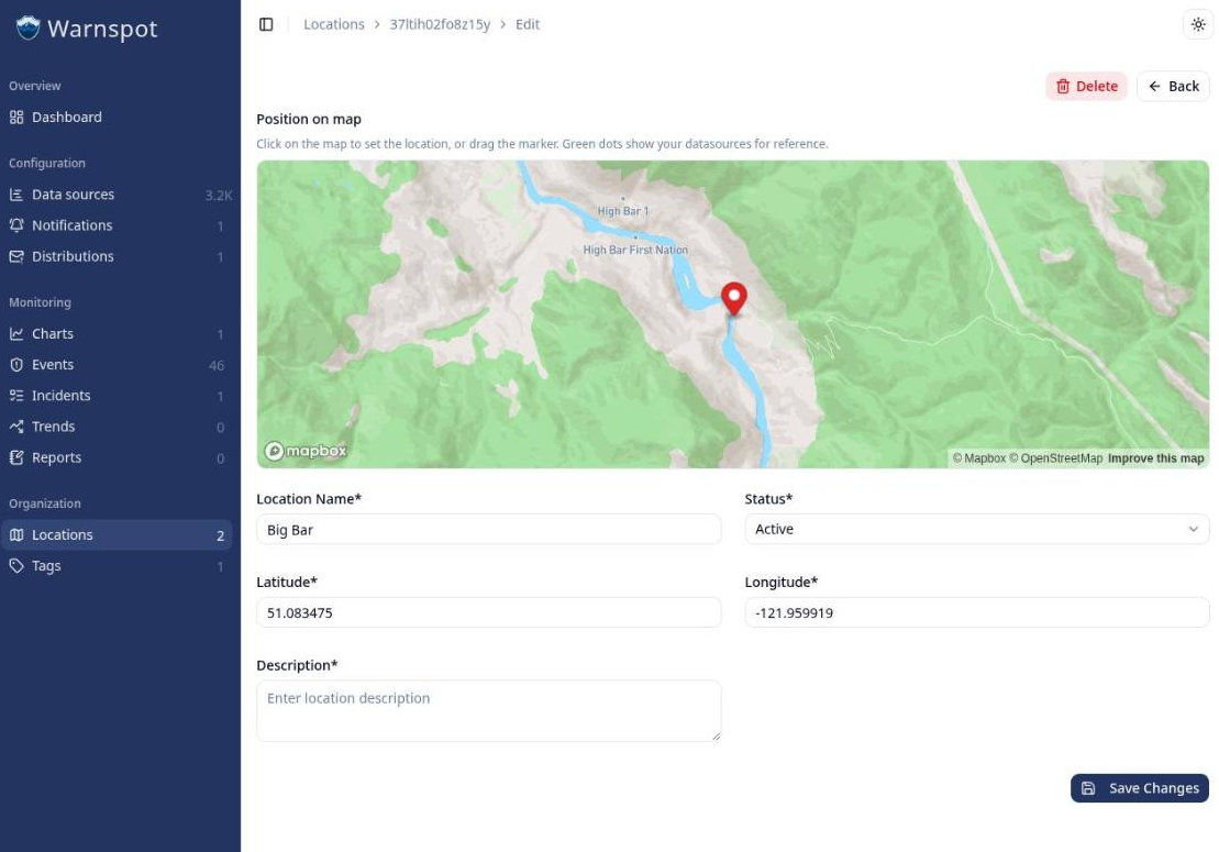
Open Locations, click Add location, and give it a name and a geopoint. For this campaign the
name is Big Bar and the geopoint is 51.083475, -121.959919. You can type the coordinates or drop
the marker on the map.
Add data sources
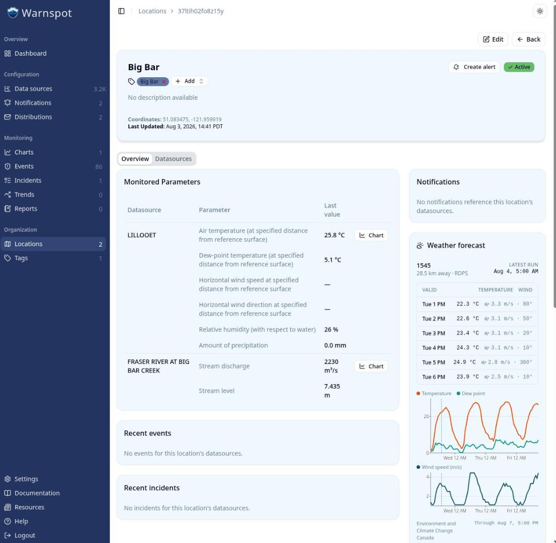
A location groups measurements from public stations and from your own private data sources. Two public stations sit close enough to Big Bar to describe conditions at the work site, so the crew links both to the location.
The first is the Water Survey of Canada hydrometric gauge FRASER RIVER AT BIG BAR CREEK, station 08MD013, near the Big Bar reaction ferry crossing. It reports stream level in metres and stream
discharge in cubic metres per second, once an hour. This gauge is the go or no-go check. Work on the
river depends on the water level, so the crew reads the gauge before the trip and decides whether
the planned work is possible at all.
The second is the Environment and Climate Change Canada weather station LILLOOET, climate
station 1114619. It sits about 45 km south of the site, in the same Fraser River canyon, and
reports air temperature, dew point, relative humidity, wind speed and direction, and precipitation.
Both stations are already listed on the Data sources page as public data sources. Search for
each station by name, open its page, and click Add to location to link it to Big Bar. Both
stations now appear on the location page with their latest readings and charts.
Create a heat safety notification
Summer heat in the Fraser Canyon is a real hazard for a crew working outdoors. A notification turns the Lillooet air temperature into a message that reaches people in the field.
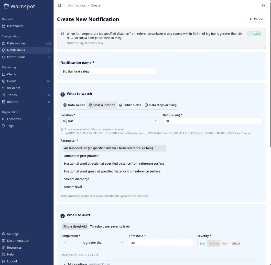
Open Notifications, click Create notification, and build the rule:
- Set the scope to the
Big Barlocation. - Choose the air temperature parameter from the Lillooet station.
- Set the condition to above 30 °C.
Note: Warnspot currently evaluates notifications on measured values, not forecasts. The notification triggers when the latest air temperature reading is above 30 °C. In the future, Warnspot will support forecast-based notifications, which would be more useful in this scenario.
Review forecast, warnings, and road conditions
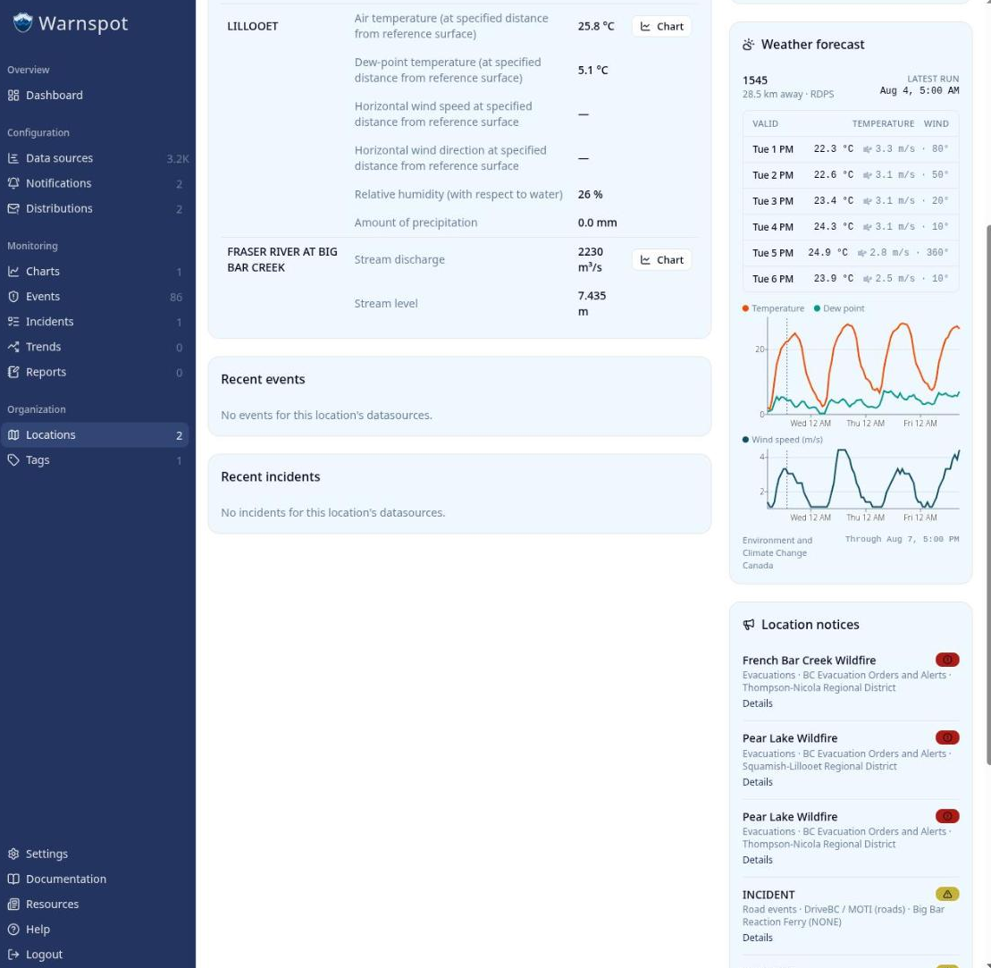
Besides the measurements from the linked data sources, Warnspot shows three more things for the location:
- A nearby PROGNOS weather forecast.
- Environment and Climate Change Canada weather warnings and statements.
- DriveBC road events near the location, such as closures, delays, and ferry notices.
During this campaign the location view shows two active public alerts for the area. One is a wildfire evacuation order. The other is a Ministry of Transportation notice that the nearby Big Bar reaction ferry is not in service. Both are highly relevant to a crew that assesses site conditions before they leave. Seeing them next to the river gauge and the forecast makes a go or no-go decision one check instead of four.
Define a distribution
By default a notification reaches the account owner. That is the wrong person when the account owner is in the office and the crew is in the canyon.
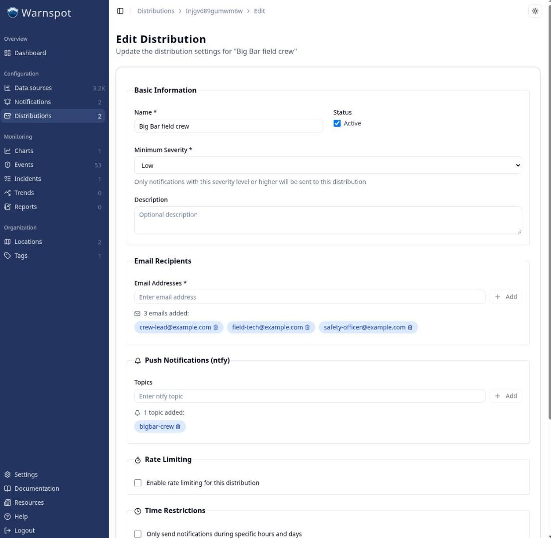
A distribution is a named list of recipients. Open Distributions, click Create distribution, and add the email address of every crew member. On plans that include push notifications, also add a push topic that the crew subscribes to in the ntfy app. Then attach the distribution to the heat notification.
Note: SMS notifications are not available in Warnspot yet. The ntfy push notification channel is a good alternative for field crews with smartphones that have mobile data or satellite internet. The ntfy app is free and open source, and works on Android, iOS, and desktop.
What the crew has now
One location holds the river gauge, the weather station, the forecast, the public alerts, and the notification. The morning check is one page. The heat notification reaches the crew in the field instead of waiting for someone to open a browser. The same pattern works for any site with public stations nearby, and for your own sensors after you connect them through the Warnspot API.
Set up your own site
Warnspot brings public stations, forecasts, and safety alerts for one place onto one page, and sends the notifications that matter to the people who are there. Create an account to start your free 14-day trial and add your first location, or contact us about connecting your own field instruments. The trial needs no credit card.